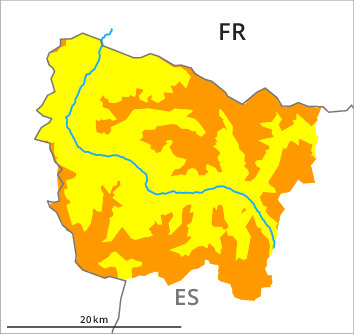
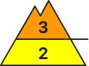
Danger level
2200m
Avalanche Problem

Wind-drifted snow

2200m

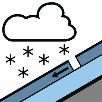
New snow
2000m

New snow and wind slabs as the day progresses. By the evening possibly danger level 3 (considerable) will be reached at high altitude.
As a consequence of new snow and wind more frequent dry snow slides and avalanches are to be expected as the day progresses, but they can reach medium size in some cases. These can to an increasing extent be released easily or triggered naturally. The avalanche prone locations are to be found in particular on wind-protected shady slopes at intermediate and high altitudes and on wind-loaded slopes above approximately 2200 m.
The avalanche prone locations are barely recognisable because of the poor visibility. Backcountry touring and other off-piste activities call for experience and restraint.
The avalanche prone locations are barely recognisable because of the poor visibility. Backcountry touring and other off-piste activities call for experience and restraint.
Snowpack
>15 to 20 cm of snow, and up to 25 cm in some localities, will fall until Saturday above approximately 2000 m. The northerly wind will transport the new snow. The cold fresh snow and the wind slabs that are forming during the snowfall will be deposited on a quite favourable old snowpack in all aspects.
At intermediate and high altitudes snow depths vary greatly, depending on the infuence of the wind. At low altitude from a snow sport perspective, in most cases insufficient snow is lying.
At intermediate and high altitudes snow depths vary greatly, depending on the infuence of the wind. At low altitude from a snow sport perspective, in most cases insufficient snow is lying.
Tendency
Slight decrease in danger of dry avalanches as the snowfall eases. As a consequence of a moderate to strong northeasterly wind, further wind slabs will form on Saturday.