Danger level

2600m
Avalanche Problem

Wet snow

2600m

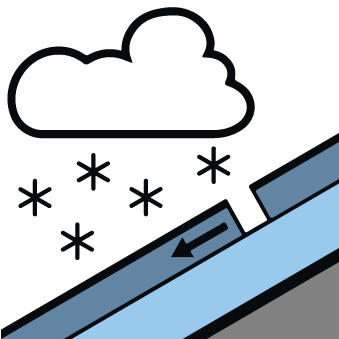
New snow

2000m
Moist snow slides and avalanches are still possible through to the middle of the day. Dry snow slides and avalanches are possible from the middle of the day.
The sleet will give rise by midday to significant moistening of the snowpack in some places in all aspects below approximately 2600 m. As the penetration by moisture increases moist snow slides and avalanches are possible at any time, but they will be mostly small.
As a consequence of the snowfall the prevalence and size of the avalanche prone locations will increase from midday. The cold fresh snow as well as the small wind slabs will become increasingly prone to triggering in all aspects above approximately 2000 m.
As a consequence of the snowfall the prevalence and size of the avalanche prone locations will increase from midday. The cold fresh snow as well as the small wind slabs will become increasingly prone to triggering in all aspects above approximately 2000 m.
Snowpack
>All aspects and: Early morning: The snowpack is largely stable and its surface has a crust that is barely capable of bearing a load. On steep slopes and below approximately 2600 m the snowpack will soften quicker than the day before.
Steep, little used shady slopes high altitudes and the high Alpine regions: The snowpack remains weakly bonded in particular in areas where the snow cover is rather shallow.
In some localities up to 2 cm of snow will fall until late morning above approximately 2200 m. The southerly wind will transport only a little snow. In particular in the northern half of Aran 10 to 15 cm of snow, and even more in some localities, will fall from midday.
In all regions at intermediate and high altitudes less snow than usual is lying. At low altitude from a snow sport perspective, insufficient snow is lying.
Tendency
Significant increase in danger of dry avalanches as a consequence of the snowfall.