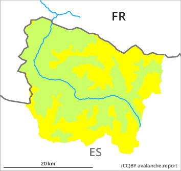
Danger level

2400m
Avalanche Problem

Wind-drifted snow

2400m

Wet snow
1800m

Wind slabs and wet snow require caution.
As a consequence of new snow and a light to moderate northwesterly wind, mostly shallow wind slabs formed on Saturday in particular in the east and in the south. As a consequence of a sometimes strong northwesterly wind, mostly small wind slabs will form in the course of the day adjacent to ridgelines on northeast, east and southeast facing slopes. They can in some cases be released, even by a single winter sport participant and reach medium size. This applies in particular on very steep northeast, east and southeast facing slopes in particular at high altitude, and adjacent to ridgelines.
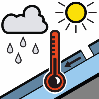
As a consequence of the solar radiation, the likelihood of moist loose snow avalanches being released will increase a little on very steep sunny slopes at intermediate and high altitudes. The avalanches in these loacations are small but easily released.
Backcountry touring calls for caution and restraint.
Snowpack
>
Up to 10 cm of snow, and up to 15 cm in some localities, fell on Saturday above approximately 1500 m. The wind was light to moderate in particular in the southeast and in the south. Today the wind will be strong to storm force. Especially adjacent to ridgelines and in pass areas further wind slabs will form.
Above approximately 2000 m there are 100 to 200 cm of snow, and even more in some localities. Snow depths vary greatly at elevated altitudes, depending on the infuence of the wind.
Above approximately 2000 m there are 100 to 200 cm of snow, and even more in some localities. Snow depths vary greatly at elevated altitudes, depending on the infuence of the wind.
Tendency
Slight decrease in danger of dry avalanches as a consequence of warming during the day and solar radiation. The danger of dry avalanches will persist.