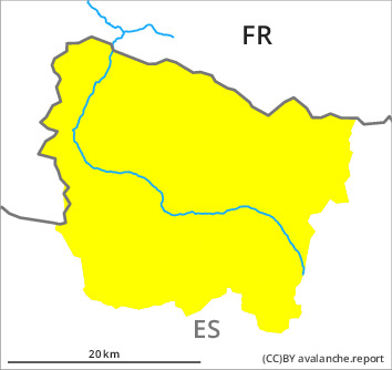
Danger level

Avalanche Problem
Wet snow

Gliding snow


Wet and gliding snow represent the main danger. In addition the sometimes avalanche-prone wind slabs must be taken into account.
As a consequence of warming during the day and solar radiation numerous small and, in isolated cases, medium-sized moist avalanches are to be expected. The avalanche prone locations are to be found in particular on very steep sunny slopes in all altitude zones.
Very steep grassy slopes: Gliding avalanches are likely to occur. Sometimes Explanation: "these" may only stand for "these avalanches" are medium-sized.
The old wind slabs of last week can be released by a single winter sport participant on shady slopes and generally above the tree line. Explanation: "these" may only stand for "these avalanches" are rather small.
Backcountry touring and other off-piste activities call for experience and restraint.
Snowpack
>
East, south and west facing slopes: The surface of the snowpack has frozen to form a strong crust and will already soften in the late morning. Sunshine and high temperatures will give rise as the day progresses to increasing moistening of the snowpack especially on very steep sunny slopes.
Shady slopes: The upper section of the snowpack is dry. The new snow and wind slabs of the last few days are lying on surface hoar in some places above the tree line.
Above the tree line there are 50 to 80 cm of snow. In particular at high altitude snow depths vary greatly, depending on the infuence of the wind.
Tendency
Thursday: The danger of wet and gliding avalanches will decrease quickly. Gradual increase in danger of dry avalanches as a consequence of new snow and wind.