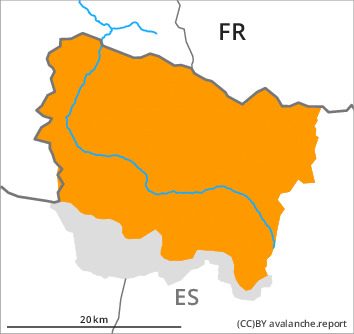
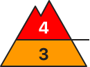
Danger level
2000m
Avalanche Problem

Wind slab

2000m


Wet snow
2000m
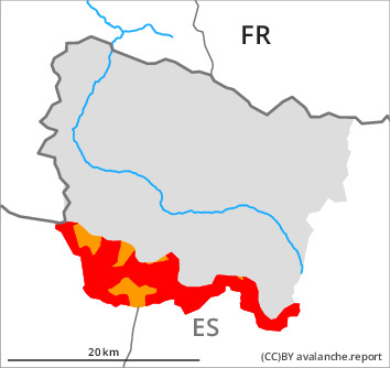
The danger of dry and moist avalanches will increase quickly during the day. The conditions are very dangerous for backcountry touring.
As a consequence of new snow and a sometimes strong southerly wind, further wind slabs will form from early morning in particular adjacent to ridgelines on north, northeast facing slopes. The fresh and somewhat older wind slabs can be released easily. or in isolated cases naturally, in all aspects at intermediate and high altitudes. Sometimes avalanches are large.
Dry avalanches can also be triggered in the old snowpack and reach dangerously large size.
During the day: As a consequence of the rain moist snow slides and avalanches are possible, even large ones in isolated cases. Gliding avalanches are also to be expected at any time.
Backcountry touring calls for very extensive experience in the assessment of avalanche danger and great restraint.
Snowpack
>
30 to 50 cm of snow, and even more in some localities, fell in the last three days above approximately 1500 m. In particular in the south and in the southwest 10 to 20 cm of snow will fall above approximately 2000 m. Up to 2200 m rain will fall. The southerly wind will transport the new snow and, in some cases, old snow as well. Over a wide area new snow and wind slabs are lying on a weakly bonded old snowpack.
Large-grained weak layers exist in the bottom section of the old snowpack in particular on west, north and east facing slopes.
At intermediate altitudes there are 130 to 170 cm of snow, and even more in some localities.
Large-grained weak layers exist in the bottom section of the old snowpack in particular on west, north and east facing slopes.
At intermediate altitudes there are 130 to 170 cm of snow, and even more in some localities.
Tendency
Tuesday: Significant decrease in danger of moist avalanches as the temperature drops.