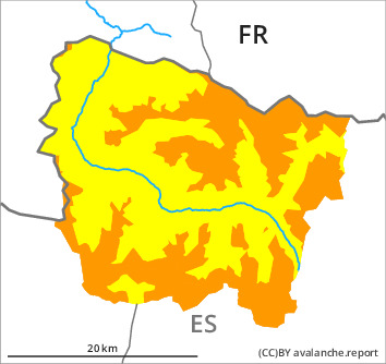
Danger level

treeline
Avalanche Problem

Wind slab

Treeline


New snow
1500m
The new snow and wind slabs represent the main danger. As a consequence of new snow and strong wind the avalanche prone locations will become more prevalent as the day progresses.
The extensive wind slabs can be released easily. or in isolated cases naturally, in all aspects and generally above the tree line. In the regions exposed to a lot of wind caution is to be exercised in particular in gullies and bowls, and behind abrupt changes in the terrain, in particular. Sometimes the avalanches are medium-sized.
As a consequence of the new snow more frequent dry avalanches are possible as the day progresses, even medium-sized ones. Additionally dry avalanches can be triggered in the old snowpack and reach large size in particular on steep shady slopes.
The avalanche prone locations are numerous and are barely recognisable because of the poor visibility. Ski touring and other off-piste activities, including snowshoe hiking, call for great caution and restraint.
Snowpack
>
Over a wide area 25 to 30 cm of snow, and even more in some localities, will fall until Sunday above approximately 1500 m. The sometimes storm force wind will transport the new snow significantly. As a consequence of the storm force northerly wind, the snow drift accumulations will increase in size at the weekend.
The wind slabs are lying on weak layers in particular on shady slopes above approximately 2200 m. In particular places where surface hoar has been covered with snow are especially dangerous.
At intermediate altitudes there are 150 to 200 cm of snow, and even more in some localities.
The wind slabs are lying on weak layers in particular on shady slopes above approximately 2200 m. In particular places where surface hoar has been covered with snow are especially dangerous.
At intermediate altitudes there are 150 to 200 cm of snow, and even more in some localities.
Tendency
Sunday: Slight increase in danger of dry avalanches as a consequence of the strong to storm force northerly wind.