Danger level
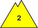
2000m
Avalanche Problem

Wind-drifted snow

2000m


Wet snow
1800m

Wind slabs and wet snow are to be critically assessed.
As a consequence of new snow and a sometimes strong wind from northwesterly directions, avalanche prone wind slabs formed on Friday in particular adjacent to ridgelines on north, east and south facing slopes. These can be released by people and reach medium size. The somewhat older wind slabs are to be found in particular at the southern and eastern borders of Aran and generally at elevated altitudes. They are in some cases prone to triggering. In particular in gullies and bowls, and behind abrupt changes in the terrain these can be released in the new snow and wind slab layers and reach medium size in some cases.
As a consequence of warming during the day and solar radiation more moist snow slides and avalanches are to be expected as the day progresses, even medium-sized ones.
The current avalanche situation calls for experience in the assessment of avalanche danger and careful route selection.
As a consequence of warming during the day and solar radiation more moist snow slides and avalanches are to be expected as the day progresses, even medium-sized ones.
The current avalanche situation calls for experience in the assessment of avalanche danger and careful route selection.
Snowpack
>Over a wide area 10 to 15 cm of snow, and even more in some localities, fell on Friday above approximately 1800 m. The northwesterly wind has transported the new snow significantly.
Fresh and somewhat older wind slabs remain for the foreseeable future prone to triggering in particular on north to east to south facing aspects at elevated altitudes.
At intermediate and high altitudes snow depths vary greatly, depending on the infuence of the wind. At low altitude from a snow sport perspective, insufficient snow is lying.
Tendency
Gradual decrease in danger of dry and moist avalanches.