Danger level
2500m
Avalanche Problem
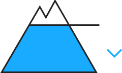
Gliding snow
2500m


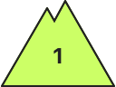
Wind-drifted snow

2300m

Gliding avalanches are possible in isolated cases as before. Fresh wind slabs as the day progresses.
As a consequence of the moist air more gliding avalanches are possible at any time, even medium-sized ones. The avalanche prone locations are to be found in particular on west, north and east facing slopes at low and intermediate altitudes and on very steep grassy slopes below approximately 2500 m. Areas with glide cracks are to be avoided.
As a consequence of new snow and a moderate to strong westerly wind, sometimes avalanche prone wind slabs will form in the course of the day in particular adjacent to ridgelines on northeast, east and southeast facing slopes. Individual avalanche prone locations are to be found in particular in steep terrain at high altitude. The fresh wind slabs can to an increasing extent be released easily, but they will be small in most cases.
As a consequence of new snow and a moderate to strong westerly wind, sometimes avalanche prone wind slabs will form in the course of the day in particular adjacent to ridgelines on northeast, east and southeast facing slopes. Individual avalanche prone locations are to be found in particular in steep terrain at high altitude. The fresh wind slabs can to an increasing extent be released easily, but they will be small in most cases.
Snowpack
>
In the last few days on very steep grassy slopes further small and, in isolated cases, medium-sized avalanches occurred naturally. As a consequence of falling temperatures the snowpack consolidated during the last two days. The high humditiy will give rise as the day progresses to increasing moistening of the snowpack in all aspects in particular at low and intermediate altitudes. Intermediate and high altitudes: Some snow will fall on Monday. The sometimes strong wind will transport the new snow and, in some cases, old snow as well.
A lot of snow is lying for the time of year in all altitude zones.
A lot of snow is lying for the time of year in all altitude zones.
Tendency
Tuesday: Slight increase in danger of gliding avalanches and moist snow slides as a consequence of the rain. In particular at high altitudes and in high Alpine regions further wind slabs will form.