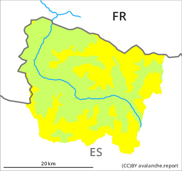
Danger level

2200m
Avalanche Problem

Wind-drifted snow

2200m

Wet snow


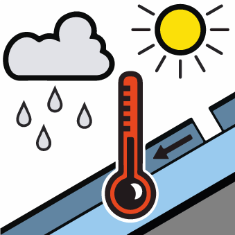
Fresh wind slabs represent the main danger. Moist snow slides during the day are possible.
As a consequence of new snow and a moderate to strong wind from northerly directions, sometimes easily released wind slabs formed in particular in gullies and bowls and behind abrupt changes in the terrain. The fresh wind slabs are lying on weak layers on wind-protected shady slopes above the tree line. They are mostly small but prone to triggering. In addition the sometimes deep wind slabs adjacent to ridgelines on southeast, south and southwest facing slopes and generally at elevated altitudes are easily triggered for a short time. As a consequence of warming during the day and solar radiation small and, in isolated cases, medium-sized moist snow slides and avalanches are possible.
On wind-loaded slopes an unfavourable avalanche situation will be encountered in some localities. Backcountry touring and other off-piste activities call for meticulous route selection.
On wind-loaded slopes an unfavourable avalanche situation will be encountered in some localities. Backcountry touring and other off-piste activities call for meticulous route selection.
Snowpack
>
Over a wide area up to 5 cm of snow, and even more in some localities, has fallen since Monday above approximately 2000 m. The sometimes strong wind has transported the fresh and old snow significantly. The new snow and wind slabs are bonding only slowly with the old snowpack in particular on wind-protected shady slopes. Outgoing longwave radiation during the night was quite good. The surface of the snowpack will soften during the day.
Above approximately 2000 m there are 100 to 200 cm of snow, and even more in some localities. Snow depths vary greatly at elevated altitudes, depending on the infuence of the wind.
Above approximately 2000 m there are 100 to 200 cm of snow, and even more in some localities. Snow depths vary greatly at elevated altitudes, depending on the infuence of the wind.
Tendency
Thursday: Gradual decrease in danger of dry and moist avalanches on sunny slopes. Hardly any decrease in danger of dry avalanches on wind-protected shady slopes.