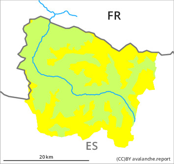
Danger level

2000m
Avalanche Problem

Wind-drifted snow

2000m

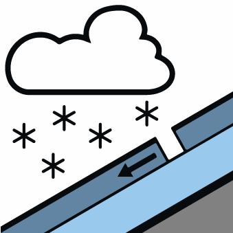
New snow
2000m

New snow and wind slabs require caution.
As a consequence of new snow and a light to moderate wind from westerly directions, avalanche prone wind slabs will form in the course of the day in some localities. The new snow and wind slabs can be released easily, or, in isolated cases naturally. This applies in particular on very steep north, east and south facing slopes at intermediate and high altitudes, as well as adjacent to ridgelines in all aspects. Avalanches are rather small but easily released.
The avalanche prone locations are barely recognisable because of the poor visibility. Backcountry touring calls for a certain restraint.
The avalanche prone locations are barely recognisable because of the poor visibility. Backcountry touring calls for a certain restraint.
Snowpack
>
As a consequence of falling temperatures a crust will form on the surface during the night. Up to 10 cm of snow, and up to 15 cm in some localities, will fall until the evening above approximately 1500 m. The wind will be light to moderate.
Above approximately 2000 m there are 100 to 200 cm of snow, and even more in some localities. Snow depths vary greatly at elevated altitudes, depending on the infuence of the wind.
The weather report and anticipated change in the avalanche danger are uncertain. We recommend that you consult the most recent avalanche bulletin.
Tendency
Significant increase in danger of moist avalanches as a consequence of warming during the day and solar radiation. The danger of dry avalanches will decrease gradually.