Danger level
2000m
Avalanche Problem
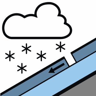
New snow

2000m


Wind-drifted snow
2000m

A mostly favourable avalanche situation will prevail.
Fresh and older wind slabs represent the main danger.
Fresh and older wind slabs represent the main danger.
The small quantity of fresh snow as well as the mostly small wind slabs will be deposited on a crust on sunny slopes above approximately 2000 m. The avalanche prone locations are to be found in particular in extreme terrain at intermediate and high altitudes and on wind-loaded slopes. The avalanches in these loacations are only small but in many cases easily released.
In addition the hard wind slabs of last week in particular adjacent to ridgelines on north and east facing slopes and at high altitudes are capable of being triggered in isolated cases still. They are lying on weak layers on wind-protected shady slopes. The avalanches in these loacations are rather small and can mostly only be released by large loads.
In addition the hard wind slabs of last week in particular adjacent to ridgelines on north and east facing slopes and at high altitudes are capable of being triggered in isolated cases still. They are lying on weak layers on wind-protected shady slopes. The avalanches in these loacations are rather small and can mostly only be released by large loads.
Snowpack
>
Over a wide area 5 to 10 cm of snow will fall until late in the night above approximately 1800 m. The wind will be light to moderate adjacent to ridgelines.
Steep sunny slopes: The surface of the snowpack will freeze to form a strong crust and will hardly soften at all. Very steep shady slopes and adjacent to ridgelines: There is a danger of falling on the hard crust.
Steep sunny slopes: The surface of the snowpack will freeze to form a strong crust and will hardly soften at all. Very steep shady slopes and adjacent to ridgelines: There is a danger of falling on the hard crust.
Tendency
On Thursday it will be partly cloudy. Slight increase in danger of moist snow slides as a consequence of solar radiation. The danger of dry avalanches will persist.