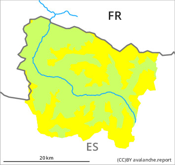
Danger level

2200m
Avalanche Problem

Wind-drifted snow

2200m

Persistent weak layer
2300m

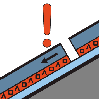
Wind slabs and weakly bonded old snow require caution.
As a consequence of new snow and a moderate to strong northwesterly wind, mostly shallow wind slabs will form by the early morning in particular adjacent to ridgelines and in gullies and bowls. The fresh wind slabs are mostly small but in some cases prone to triggering. Weak layers in the old snowpack can be released in some places by people also on steep, little used shady slopes. Sometimes they are medium-sized and in isolated cases easily released.
In addition a latent danger of gliding avalanches and moist snow slides exists.
Backcountry touring and other off-piste activities call for meticulous route selection.
In addition a latent danger of gliding avalanches and moist snow slides exists.
Backcountry touring and other off-piste activities call for meticulous route selection.
Snowpack
>
The new snow of last week has settled to a large extent in all aspects. This snow is lying on the unfavourable surface of an old snowpack in particular on shady slopes and at high altitude. Snow profiles and stability tests show a treacherous avalanche situation. Friday: All aspects: The snowpack will be generally moist. Saturday: Some snow will fall until midday in particular in the north. The northwesterly wind will transport the new snow significantly. As a consequence of falling temperatures and the moderate to strong northerly wind, a crust will form on the surface during the course of the night.
Tendency
Sunday: Rapid decrease in danger of dry avalanches on wind-loaded slopes. Significant increase in danger of wet and gliding avalanches as a consequence of warming during the day and solar radiation.