Danger level

Avalanche Problem
Wet snow


Wind-drifted snow

2400m
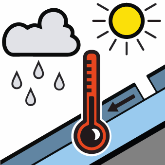
Moist snow slides during the day and gliding avalanches. Wind slabs and weakly bonded old snow require caution.
As a consequence of warming during the day and solar radiation small and, in isolated cases, medium-sized gliding avalanches and moist snow slides are to be expected.
As a consequence of new snow and a moderate to strong northwesterly wind, clearly visible wind slabs formed on Saturday in particular adjacent to ridgelines and in gullies and bowls as well as at elevated altitudes. The fresh wind slabs are mostly small but in some cases prone to triggering. Weak layers in the old snowpack can be released in some places by people also on steep, little used shady slopes. Sometimes they are medium-sized and in isolated cases easily released.
The current avalanche situation calls for meticulous route selection. Backcountry tours and off-piste skiing should be concluded by around midday.
Snowpack
>
Saturday: Some snow has fallen. The northwesterly wind has transported the new snow significantly. As a consequence of falling temperatures the snowpack consolidated. Sunday: As a consequence of rising temperatures and significant solar radiation the snow drift accumulations will stabilise. The surface of the snowpack will already soften in the late morning. Faceted weak layers exist in the old snowpack in particular on little-used, rather lightly snow-covered shady slopes. Weak layers in the old snowpack necessitate caution.
Tendency
Monday: The weather will be very warm. Further increase in danger of wet and gliding avalanches.