Danger level

Avalanche Problem
Wet snow


Wind-drifted snow

2400m
Wind slabs and wet snow require caution.
The moist fresh snow as well as the mostly small wind slabs must be evaluated with care and prudence in all aspects and generally at intermediate and high altitudes. As a consequence of new snow and a light to moderate wind from variable directions, sometimes avalanche prone wind slabs formed in the last two days in particular adjacent to ridgelines and in gullies and bowls as well as at elevated altitudes. The wind slabs are mostly small but prone to triggering.
All aspects steep terrain that is interspersed with rocks: As a consequence of warming during the day and solar radiation more frequent loose snow slides are to be expected as the day progresses, even medium-sized ones.
In addition a latent danger of gliding avalanches exists. Backcountry touring calls for meticulous route selection.
Snowpack
>
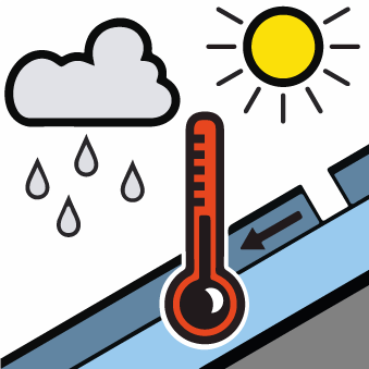
20 cm of snow, and even more in some localities, has fallen since Tuesday above approximately 2000 m. The sometimes moderate wind has transported the new snow. Some snow will fall until the early morning in some localities. In the next few hours the weather will be cloudy. These weather conditions will cause a slow strengthening of the old snowpack in all aspects.
In particular at intermediate and high altitudes there is still a very large amount of snow. The Avalanche Warning Service currently has only a small amount of information that has been collected in the high Alpine regions, so that the avalanche danger should be investigated especially thoroughly in the relevant locality.
In particular at intermediate and high altitudes there is still a very large amount of snow. The Avalanche Warning Service currently has only a small amount of information that has been collected in the high Alpine regions, so that the avalanche danger should be investigated especially thoroughly in the relevant locality.
Tendency
Some snow will fall on Saturday. As a consequence of new snow and a strong southwesterly wind, further wind slabs will form in particular on north facing slopes. Temporary decrease in danger of moist avalanches as the temperature drops.