Danger level

Avalanche Problem

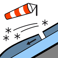
Wind slab


Fresh wind slabs towards the evening.
As a consequence of new snow and a moderate to strong wind from northwesterly directions, wind slabs will form towards the evening on east and south facing slopes. They will be deposited on a crust. Wind slabs can in some places be released by people, but they will be small in most cases.
In the evening potentially danger level 2 (moderate) will be reached above approximately 2000 m.
In the evening potentially danger level 2 (moderate) will be reached above approximately 2000 m.
Snowpack
>
The clearly visible wind slabs of Monday have bonded well with the old snowpack. The surface of the snowpack will freeze to form a strong crust and will hardly soften at all.
On Saturday it will be cloudy. Down to low altitudes snow will fall from midday. Up to 10 cm of snow will fall until late in the night above approximately 1500 m. The sometimes strong wind will transport the new snow significantly.
On Saturday it will be cloudy. Down to low altitudes snow will fall from midday. Up to 10 cm of snow will fall until late in the night above approximately 1500 m. The sometimes strong wind will transport the new snow significantly.
Tendency
Sunday: Sharp increase in danger of dry avalanches as a consequence of new snow and strong wind.