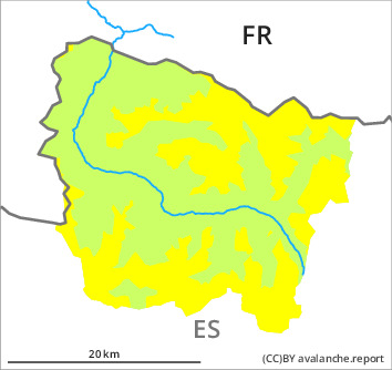
Danger level

1500m
Avalanche Problem

Wet snow

1500m


Wind slab
2500m

Significant increase in danger of wet avalanches as a consequence of the rain. Wind slabs at elevated altitudes.
As a consequence of the rain more frequent small and, in isolated cases, medium-sized wet snow slides and avalanches are to be expected. The avalanche prone locations are to be found in particular on very steep shady slopes in all altitude zones and on very steep grassy slopes above approximately 1500 m.
In addition sometimes avalanche prone wind slabs will form in the vicinity of peaks towards the evening. They are only small.
The conditions are unfavourable for off-piste activities in steep terrain. Apart from the danger of being buried, restraint should be exercised in particular in view of the danger of avalanches sweeping people along and giving rise to falls. The Avalanche Warning Service currently has only a small amount of information about the snowpack, so that the avalanche danger should be investigated especially thoroughly in the relevant locality.
Snowpack
>
Up to high altitudes rain will fall on Thursday. In the vicinity of peaks: The southerly wind will transport only a little snow. The rain will give rise as the day progresses to increasing moistening of the snowpack in all aspects in all altitude zones.
Above approximately 2000 m there are 20 to 50 cm of snow, and even more in some localities. Snow depths vary greatly at intermediate and high altitudes, depending on the infuence of the wind. At low altitude from a snow sport perspective, insufficient snow is lying.
Above approximately 2000 m there are 20 to 50 cm of snow, and even more in some localities. Snow depths vary greatly at intermediate and high altitudes, depending on the infuence of the wind. At low altitude from a snow sport perspective, insufficient snow is lying.
Tendency
Friday: Significant decrease in danger of moist avalanches as the temperature drops. Increase in danger of dry avalanches as the snowfall level drops.