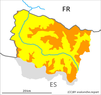
Danger level

1500m
Avalanche Problem

Wind slab

1500m


New snow

Fresh wind slabs represent the main danger.
As a consequence of the strong to storm force northwesterly wind, fresh snow drift accumulations will form at the weekend. The sometimes deep wind slabs can be released easily. or in isolated cases naturally, at intermediate and high altitudes. In many cases Explanation: "these" may only stand for "these avalanches" are medium-sized.
The avalanche prone locations are to be found at intermediate and high altitudes and adjacent to ridgelines and in gullies and bowls.
The conditions are critical for backcountry touring and other off-piste activities.
The avalanche prone locations are to be found at intermediate and high altitudes and adjacent to ridgelines and in gullies and bowls.
The conditions are critical for backcountry touring and other off-piste activities.
Snowpack
>
5 to 10 cm of snow has fallen above approximately 1800 m. 20 to 30 cm of snow, and even more in some localities, will fall until the evening above approximately 1200 m. The northwesterly wind will transport the new snow significantly. The new snow and wind slabs are lying on a crust in particular on shady slopes.
Snow depths vary greatly at intermediate and high altitudes, depending on the infuence of the wind.
Snow depths vary greatly at intermediate and high altitudes, depending on the infuence of the wind.
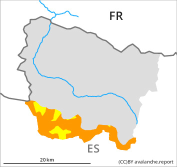
Tendency
Sunday: Slight increase in danger of dry avalanches as a consequence of new snow and wind.