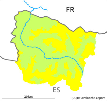
Danger level

1800m
Avalanche Problem

New snow

1800m


Wind slab
2000m

New snow in all aspects. From the middle of the day further wind slabs will form.
As a consequence of the new snow dry snow slides and avalanches are to be expected at any time, but they will be mostly small. These can be released by people or triggered naturally. The avalanche prone locations are to be found on very steep slopes at intermediate and high altitudes. As a consequence of new snow and a sometimes moderate northwesterly wind, soft wind slabs will form from the middle of the day in particular adjacent to ridgelines on northeast, east and south facing slopes. They are rather small but in many cases easily released. Even a small avalanche can sweep people along and give rise to falls. Backcountry touring and other off-piste activities call for meticulous route selection.
Snowpack
>
Over a wide area 5 to 10 cm of snow fell yesterday. 5 to 15 cm of snow, and even more in some localities, will fall until the early morning in all altitude zones. The new snow is lying on a crust in all aspects. This snow has hardly bonded at all. The sometimes moderate wind will transport the new snow. This snow will become increasingly prone to triggering.
Above approximately 2000 m there are 30 to 60 cm of snow, and even more in some localities. At low altitude from a snow sport perspective, insufficient snow is lying.
Above approximately 2000 m there are 30 to 60 cm of snow, and even more in some localities. At low altitude from a snow sport perspective, insufficient snow is lying.
Tendency
Sunday: Further increase in danger of dry and moist avalanches as the snowfall level rises. In addition further wind slabs will form on north and east facing slopes as the day progresses.