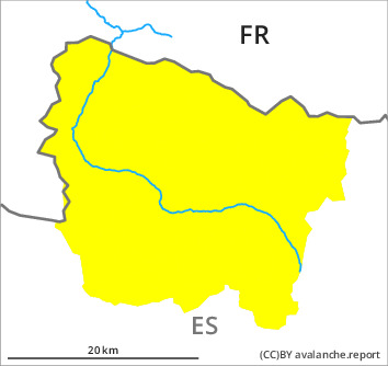
Danger level

2000m
Avalanche Problem

Persistent weak layer

2000m


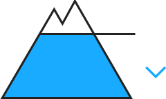
Wet snow
2400m

Weak layers in the old snowpack necessitate caution and restraint. Wet and gliding avalanches from early morning.
The new snow and wind slabs of the weekend are lying on soft layers in particular on steep shady slopes above approximately 2000 m. Sometimes the avalanches in these loacations are medium-sized and can be released easily by a single winter sport participant. They are in some cases deep and can be released easily at their margins.
In addition from midday on east, south and west facing slopes, some small and, in isolated cases, medium-sized wet and gliding avalanches are to be expected.
Backcountry touring and other off-piste activities call for careful route selection.
In addition from midday on east, south and west facing slopes, some small and, in isolated cases, medium-sized wet and gliding avalanches are to be expected.
Backcountry touring and other off-piste activities call for careful route selection.
Snowpack
>
Shady slopes, intermediate and high altitudes: Faceted weak layers exist in the centre of the snowpack in particular on northwest, north and east facing slopes. Field observations and released avalanches show the unfavourable bonding of the snowpack.
Sunny slopes: The surface of the snowpack will already soften in the late morning. Above approximately 2000 m there are 90 to 120 cm of snow, and even more in some localities.
Sunny slopes: The surface of the snowpack will already soften in the late morning. Above approximately 2000 m there are 90 to 120 cm of snow, and even more in some localities.
Tendency
Thursday: Temporary increase in danger of gliding avalanches and moist snow slides as a consequence of warming during the day.