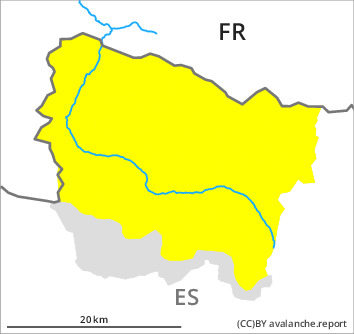
Danger level

Avalanche Problem

Wind slab


New snow
Fresh wind slabs require caution. As a consequence of new snow and stormy weather a precarious avalanche situation will prevail.
The more recent wind slabs can be released easily. or in isolated cases naturally, in all aspects above approximately 2000 m. The prevalence of avalanche prone locations and likelihood of triggering will increase as the day progresses. These places are barely recognisable because of the poor visibility. In many cases the avalanches in these loacations are medium-sized.
The new snow can be released by a single winter sport participant in isolated cases in all aspects above approximately 1800 m. The avalanches in these loacations are rather small. Fresh and somewhat older wind slabs are lying on weak layers in particular on shady slopes at intermediate and high altitudes.
Backcountry touring and other off-piste activities call for extensive experience in the assessment of avalanche danger and careful route selection.
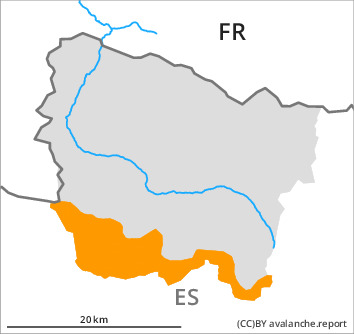
Snowpack
>
Over a wide area 10 to 20 cm of snow, and even more in some localities, will fall until the evening above approximately 1500 m. The southerly wind will transport the new snow significantly.
Shady slopes: Faceted weak layers exist in the top section of the snowpack in particular on northwest, north and east facing slopes.
Above approximately 2000 m there are 90 to 110 cm of snow, and even more in some localities.
Shady slopes: Faceted weak layers exist in the top section of the snowpack in particular on northwest, north and east facing slopes.
Above approximately 2000 m there are 90 to 110 cm of snow, and even more in some localities.
Tendency
Saturday: Gradual increase in danger of dry avalanches as a consequence of new snow and wind.