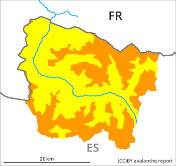
Danger level

2000m
Avalanche Problem

Wind slab

2000m


New snow
1500m
Fresh snow and large quantities of wind-drifted snow represent the main danger.
The fresh snow and in particular the sometimes deep wind slabs can be released very easily in all aspects and at intermediate and high altitudes. In the vicinity of peaks they can be released in the faceted old snow and reach medium size in isolated cases. The avalanche prone locations are to be found especially adjacent to ridgelines in all aspects above approximately 2000 m and in gullies and bowls.
The conditions are treacherous for backcountry touring and other off-piste activities. The current avalanche situation calls for experience in the assessment of avalanche danger and caution.
The conditions are treacherous for backcountry touring and other off-piste activities. The current avalanche situation calls for experience in the assessment of avalanche danger and caution.
Snowpack
>
20 to 40 cm of snow, and even more in some localities, has fallen since Friday above approximately 1500 m. 20 to 25 cm of snow, and even more in some localities, will fall on Monday. The wind will be moderate to strong over a wide area. The northwesterly wind will transport the new snow significantly.
The fresh and somewhat older wind slabs are lying on weak layers on shady slopes at intermediate and high altitudes.
Above approximately 2000 m there are 90 to 130 cm of snow, and even more in some localities.
The fresh and somewhat older wind slabs are lying on weak layers on shady slopes at intermediate and high altitudes.
Above approximately 2000 m there are 90 to 130 cm of snow, and even more in some localities.
Tendency
Tuesday: The danger of dry avalanches will decrease during the day. As a consequence of warming during the day and solar radiation there will be a significant increase in the danger of gliding avalanches and moist snow slides.